Florida Bike Month Positive Spin #2 – Off Road Rescue
Today’s guest blog is being provided by Frank Belaska of the Ocala Mountain Bike Club. Frank has prepared a special report on off road rescue, just in time for this weekend’s Santos Fat Tire Festival.
On Saturday, February 20, Marion County Fire and Rescue (MCFR) and Special Operations teams along with members of the Ocala Mountain Bike Association (OMBA) Bike Patrol (BP) team held a full scale exercise within the Marjorie Harris Carr Cross Florida Greenway Recreational Trails. The event was designed to locate and extract two injured mountain bikers somewhere within the Santos mountain bike trail system.
Over a period of 6-8 months, Captain Scott Chappell (MCFR) and myself worked on the plan which was to simulate real world conditions of down riders in areas that were in rough and inaccessible terrain.
The scenario had the following objectives:
- Stress the various fire departments and operations that support the Santos trails by performing two simultaneous rescue events
- Educate the BP members on what to provide during a 911 call
- Have the BP members assist MCFR team members as needed and to ensure other bike riders using the trail are out of the way during the rescue operations
- Include 911 operators to determine how to best relay trail location and victim conditions by the Bike Patrol Members to the MCFR team
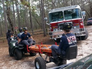
- Utilize the MCFR ATV’s and GPS units to see how well the responding teams determine the location of the victims, identify quick access and bring out the victims to the waiting rescue vehicles
Specifically the objectives were:
| Exercise Objective | Core Capability |
| Establish Location/Coordinates of Victim from 911 call | Situational Awareness |
| Communicate Victim Location to Rescuers | Situational Awareness |
| Access and Locate Victim | Search and Rescue |
| Rescue/Extract Victim | Search and Rescue |
| Treat and Transport Victim from Extraction Point to EMS Transport Unit | Search and Rescue/Emergency Medical Services |
Why Do This At All?
OMBA has seen an increase number of trail users on the western edge of the Santos trail system. This area is where the abandon Florida canal system was built back in the 70’s and although the trails are not technically challenging (they are yellow and blue rated trails) they WILL test your endurance as you ride on trails that wind through ravines and steep inclines along with rocky off camber tight turns (fun stuff!). These trails could create issues with getting to a rider quickly if an emergency occurs. When the Cross Florida Greenway is completed, the trails may see an increase of first time riders which will have the potential for increased calls for assistance. Not to mention that the OMBA Santos Fat Tire Festival this weekend will host over 500 riders.
Setting the Stage
OMBA and MCFR have been building a strong relationship over the past year and part of the partnership is having OMBA BP team help to educate the MCFR team on the locations of the trails, possible extraction points and areas of increased risks. MCFR helps provide additional training and understanding to the patrollers on what they can do to help a victim if they arrive to the victim before they do as well as help get first responders quickly to the scene.
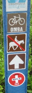
Over the past year and leading up to the exercise, OMBA BP has been adding location stickers on the Santos trail markers. Each sticker has a unique number and trail name to help the rider know where they are in case a call for help is required. Each marker GPS location has been provided to the MCFR GIS team who is in the process of adding the markers to their response maps.
These markers are used during the event to help quickly bring a patroller to support the victim and let MCFR know the GPS location to improve the response time getting to the victim as well as extracting the victim back out to the closest fire road/trail head.
The Exercise
Months prior, possible victim locations were identified and reviewed to determine how well they would support the training objectives. Two locations were found to best support the event and support a successful outcome if some of the participants had to respond to a “real” emergency (lucky for us that did not happen).
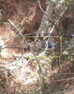
Two victims would be used. Victim #1 would not be in a good location or in best of health. In fact victim #1 was to be thrown down in a ravine off part of the Ern-n-Burn trail to simulate loss of control on a downhill turn and being thrown down the side of the trail, landing hard into a tree (about 20’ feet down).
To support this and provide a real victim experience a rescue dummy was placed the night before the event in a location known only to the exercise controllers and myself.
Bike Patroller Randy Munro would know only that a victim was somewhere on an identified trail and to initiate the call to 911 when he located the victim (more on this later). Victim #2 would be a bit better off, as they would simulate a broken ankle and be sitting on the side of the trail waiting help. Bike Patroller Debbie Todd volunteered to be the victim and was told ahead of time where to be located along with instruction on who/how to contact.
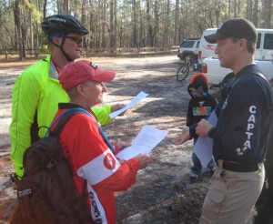
Bike Patrol Randy Munro and Debbie Todd gets instructions from Captain Chappell – photo by Frank Belaska
On the morning of February 20th, all the event participants arrived at 9am. Introductions were made and the BP team gathered together to go over the plan of the day and review the maps and marker locations that would be used during the event.
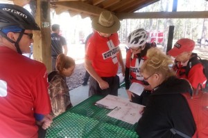
BP Patrol Lead Frank Belaska (hat) and patrollers Randy Munro, Debbie Todd, Candace Whitehead, Patti Kopec
At 9:30am Captain Chappell led a kick off session to setup the events ahead, instruct the rules of engagement and identify what would happen and how the exercise would close out at the end.
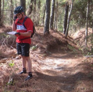
Once the meeting was completed, BP Randy Munro started riding the Ern-N-Burn Trail (located on the western end of Santos Trail System). Once he found the victim, Randy contacted 911 (indicating it was a drill) and to dispatch MCFR. While waiting for the responders he would ensure that the trail was safe to other riders and make certain no additional injuries could occur. While this was going on, I acted as an observer relying updates back to Captain Chappell to keep him informed on the progress.
At the same time Patroller Debbie was sent out to ride to the designated location and invoke her response team.
Back at Victim #1 location, Patroller Randy was in contact with 911 and identified a rider was down in a steep ravine which he could not reach without putting himself at risk and needed immediate assistance from MCFR. GPS location was gathered by using his cell phone and having the 911 operator “ping” his phone. Once done, the MCFR who was waiting at the trailhead was dispatched to the call.
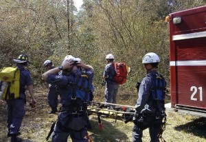
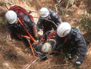
The 1st MCFR team arrived on the scene and determined (as part of the exercise scenario) to bring in the Special Operations team which was experienced in extracting victims out of extreme locations. As the special ops team was making its way to the location of the 1st response team, the Lieutenant coordinated the activities and helped direct the Special Ops team to the location which had no easy way to access except through dense woods and thickets.
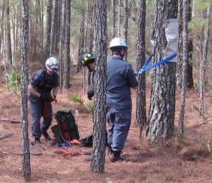
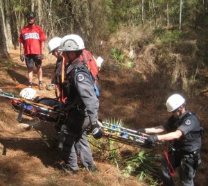
Once on the scene, the Special Ops team started developing a plan to extract out our victim to the top of the trail and walk back out to the waiting response vehicles. While the team was getting ready to go down into the ravine, Greenway Trails and Volunteer Coordinator Brian “Marshall” Gray provided MCFR an understanding of the trails, fire roads and possible best routes to remove the victim from the area.
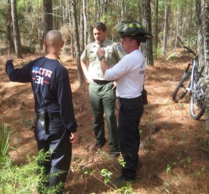
Greenway Trails Coordinator Marshall Gray and MCFR discussing best way to remove victim from scene – photo by Frank Belaska
The following photos shows the team extracting out the victim:
What about Victim #2?
As stated before, while response to victim #1 was occurring, Patroller Debbie (and her “broken ankle”) needed help. MCFR team#2 headed off onto the Nayl’s trail to locate her and provide support. The new trail markers helped in locating Debbie and she was soon heading back to the trail head.
Once the rescues were completed, everyone returned back to the trailhead and a quick debriefing was performed by Captain Chappell. Participants then sat down to enjoy lunch provided by OMBA.
Later in March an after action review conference call will be held to go over what went well and what can be improved. The identified improvements will be used in future training as well as real life rescues.
Next Steps:
Long term permanent location markers will be put into place that will have not only the name of the trail but also a US Grid number which will tell any 1st responder exactly where the victim is located. It is the vision that these markers be the same format across the entire Florida Greenway system as well as being common across the State.
Additional training exercises will be planned and it is expected that prior to each OMBA Santos Fat Tire Festival this type of exercise will be performed to ensure the best response to users of the Greenway.
Final Thoughts
Captain Chappell did an exceptional job developing the written exercise plans, identifying and contacting the exercise participants from the various fire stations around Santos and coordinating everyone before, during and after the exercise.
This was a well-executed exercise and is an example of how various organizations (MCFR, Cross Florida Greenway, OMBA) can plan and work together to better support the trail users of the Florida Greenway.
A huge thank you to all the members of the MCFR teams who were involved in this exercise and to the OMBA Bike Patrol members supporting this event:
- Patti Kopec
- Candace Whitehead
- Debbie Todd
- Randy Munro
- Sheryl Bower
We also wish to acknowledge the continued support of the Cross Florida Greenway Trails and Volunteer coordinators Marshall Gray and Bre Ximenez.
If you would like more information on this event, the trail markers or the Bike Patrol program, please contact Frank Belaska at bikepatrol@omba.org
Congratulations to our 2015 Florida Bicycle Association Annual Award recipients! Click here to see the list.
Do you have a bicycle story to tell? Photos to share? Be our guest and be our next guest blogger! Send your story and photos to Becky@floridabicycle.net. Speaking of stories, our quarterly Messenger newsletter is available online for your internet reading pleasure. Visit the FBA website Home page or click here. Want a hard copy of our Messenger? Join Florida Bicycle Association or visit one of our bicycle shop members!


